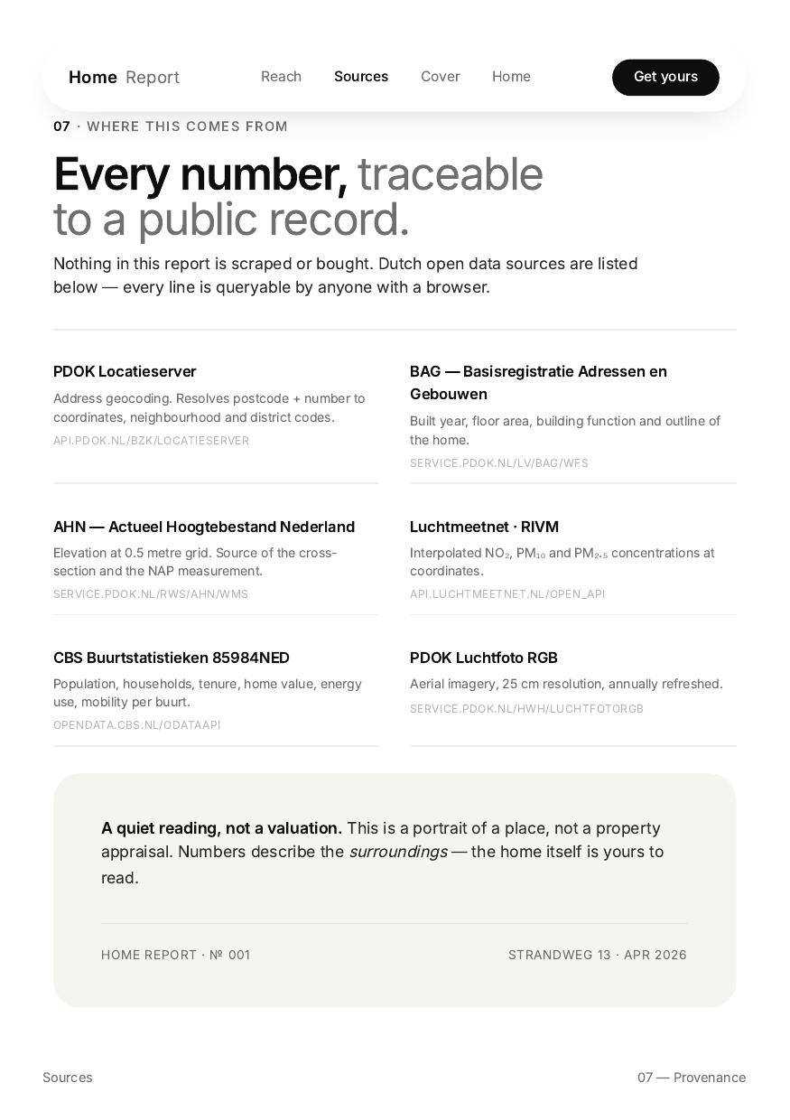
Nothing in this report is scraped or bought. Dutch open data sources are listed below — every line is queryable by anyone with a browser.
PDOK Locatieserver
Address geocoding. Resolves postcode + number to coordinates, neighbourhood, and district codes.
api.pdok.nl/bzk/locatieserver
BAG — Adressen & Gebouwen
Built year, floor area, building function and outline of the home.
service.pdok.nl/lv/bag/wfs
AHN — Actueel Hoogtebestand
Elevation at 0.5-metre grid. Source of the cross-section and the NAP measurement.
service.pdok.nl/rws/ahn/wms
Luchtmeetnet · RIVM
Interpolated NO₂, PM₁₀ and PM₂.₅ concentrations at coordinates.
api.luchtmeetnet.nl/open_api
CBS Buurtstatistieken 85984NED
Population, households, tenure, home value, energy use, mobility per neighbourhood.
opendata.cbs.nl/ODataApi
PDOK Luchtfoto RGB
Aerial imagery, 25 cm resolution, refreshed annually.
service.pdok.nl/hwh/luchtfotorgb
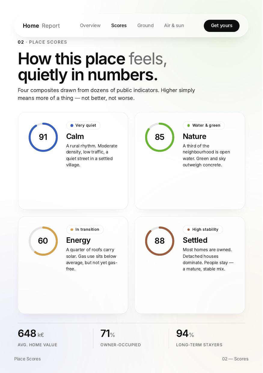
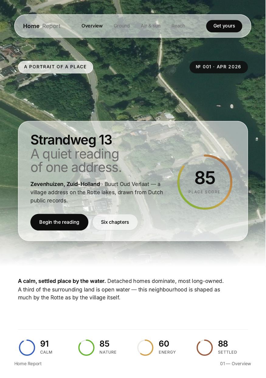 01 · Overview
 03 · Ground
 04 · Breath
 06 · Reach
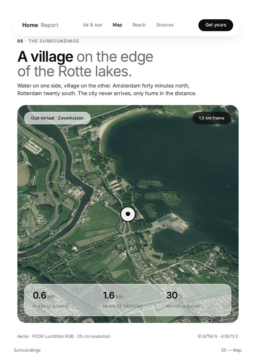